Volumes
Thanks to the platform’s integrated volume calculation, you can accurately evaluate excavation/backfill, monitor the evolution of your sites or quantify stocks of materials in just a few clicks. This browser-based functionnality simplifies your workflows, eliminates the need for cumbersome software and promotes the sharing of analyses with your teams and partners. Online volume calculation transforms altimetric data into usable information. Directly on the platform, you get accurate, shareable results, for faster decisions and better collaboration.
🛰️ Data requirements
Volume calculation require two types of input data:
- Altimetric data, this can be a point cloud, a digital elevation model (DEM) or a digital terrain model (DTM), imported onto the platform. These data are generally obtained by processing photogrammetric or LiDAR surveys with softwares such as Pix4d, Agisoft Metashape or QGIS.
- A polygon resulting from manual trimming by the user carried out directly on the platform.
🧮 Calculation methods
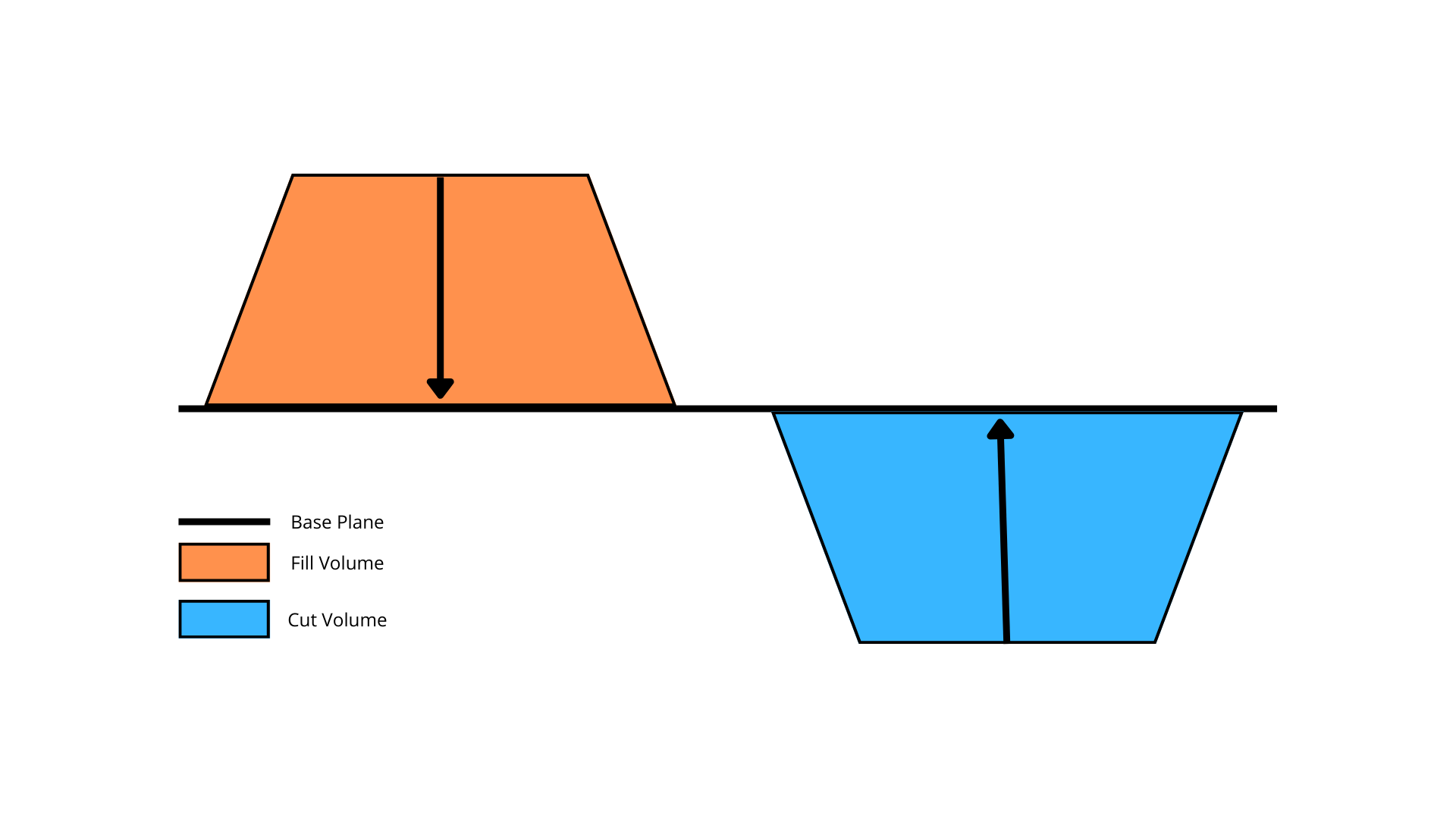
Several calculation methods are offered on the platform in order to best adapt to various scenarios. They are all based on a simple principle : a base surface is determined according to a principle specific to the calculation method used. The difference in altitude between the altimeter data deposited and this base plane constitutes the calculated volume.
Why are two volumes obtained ?
In order to provide as much information as possible, each calculation method provides two volumes:
- The cutting volume: This corresponds to the volume of material to be cleared to make the theoretical surface the actual surface.
- The fill volume: This corresponds to the volume of material to be back filled to bring the actual surface in line with the theoretical surface
What are the differences between the volume calculation methods ?
📐 Triangulation method
The triangulation method determines a theoretical base area using the principle of the Irregular Triangulated Network from the edges of the polygon.
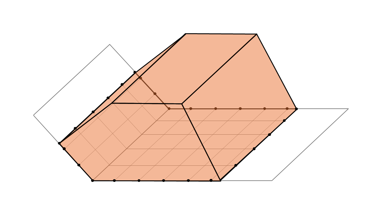
Cutting volume obtained with the triangulation method for a stockpile of material on irregular terrain.
This method adapts to rugged terrain, hugging complex reliefs.
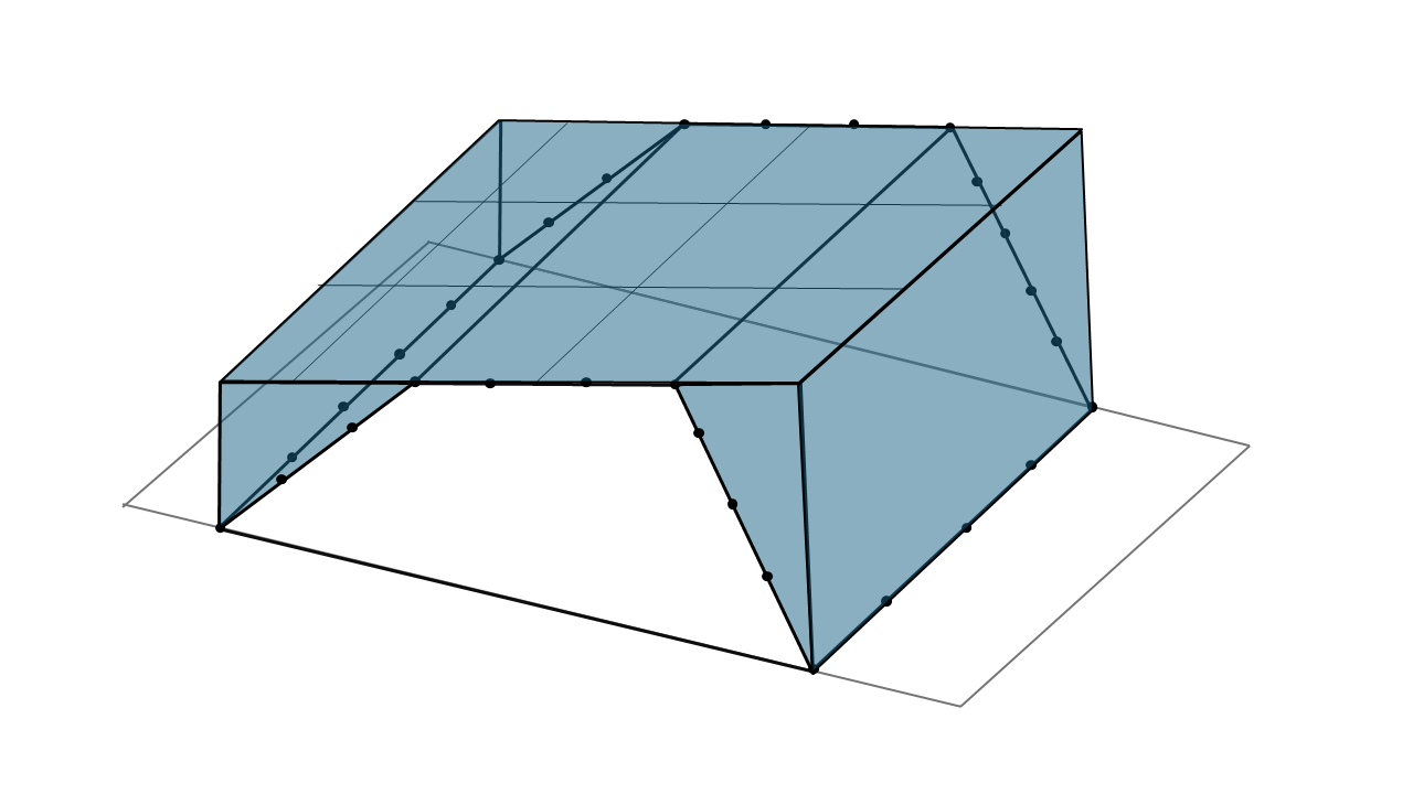
↘️ Lowest point method
The lowest point method calculates the volume between the actual surface model and a theoretical plane defined by the horizontal line passing through the lowest point of the polygon.
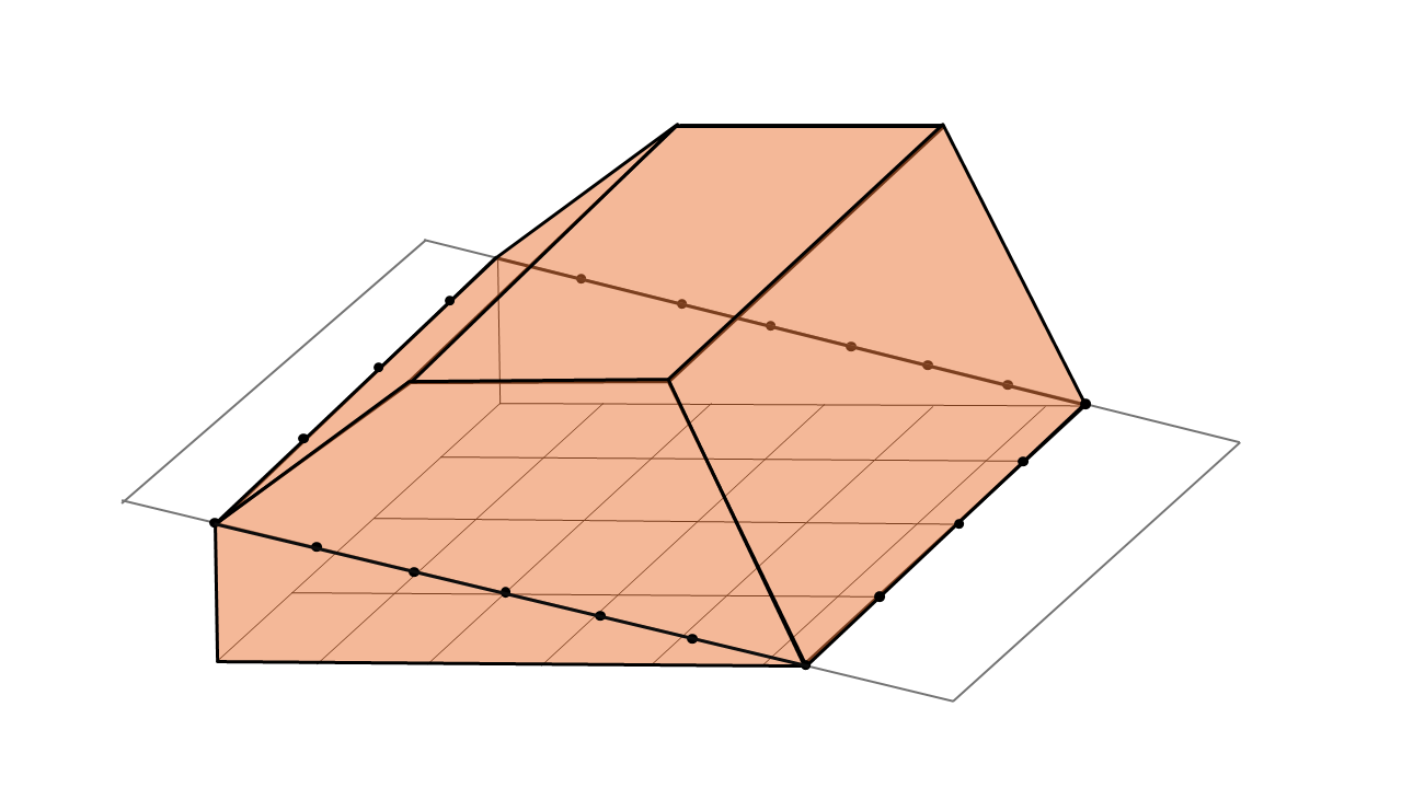
Cutting volume obtained with the lowest point method for a stockpile of material on a slopping terrain.
In case of slopping terrains, this method tends to overestimate the cutting volume. The lowest point method is best suited to flat, horizontal terrain.
〰️ Averaged plane method
The averaged plane method defines a theoretical plane minimizing the distance between the polygon’s constituent points and that same plane.
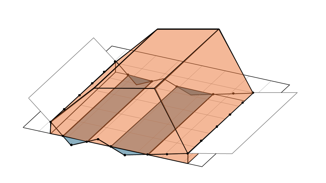
Cutting and filling volumes obtained on non-flat terrain.
Cutting volume is overestimated in areas where the ground is locally high, and underestimated in areas where the ground is locally low. On average, on terrain with little variation in roughness, over- and underestimated volumes offset each other.
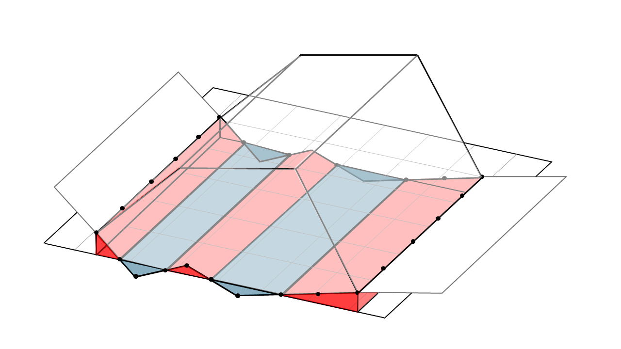
Overestimated (red) and underestimated (blue) cutting volumes
The cutting volume is therefor calculated with good accuracy.
🔧 Customized plane method
The custom plane method defines a theoretical horizontal plane corresponding to the altitude entered by the user.
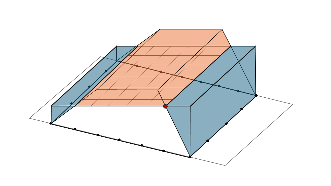
Cut and fill volumes obtained for an elevation plane set to a custom value (red dot).
↗️ Highest point
The higher point method calculates the volume between the actual surface model and a theoretical plane defined by the horizontal line passing through the highest point of the polygon.
Fill volume obtained with the highest point method for a stockpile of material on a slopping terrain.
⚠️ Precautions
Using the right method is crucial to obtaining consistent volume values, as each method uses a specific logic and best adapts to a particular context.
Before calculating a volume, it is advisable to check for the presence of outliers in the polygon that could totally distort the calculation.
The number of points digitized by the user should be sufficiently dense to accurately capture terrain variations. A sparse distribution of points may result in missing details, leading to inaccurate volume calculations.
📝 Summary
| Method | Accuracy | Ideal for |
|---|---|---|
| Triangulation | Very high | Complex terrain, quarries |
| Highest point | High to medium | Pits, excavations |
| Averaged plane | High | Slightly irregular platforms, sloping ground |
| Lowest point | High to medium | Material deposit on flat ground |
| Customized height | High | Projects with known reference altitude |