Coordinate Systems
In the fields of cartography, geolocation, or geographic information systems (GIS), it is not enough to know the position of a point (its coordinates): one must also know in which spatial framework this position is expressed. Without a clearly defined coordinate system, geographic data become ambiguous, incompatible with each other, or even unusable. Understanding the foundations of spatial reference systems is therefore an essential condition for correctly producing, sharing, or interpreting any location-based information on Earth.
There are (very) many ways to express the coordinates of a point. The value of the coordinates depends on the coordinate system in which they are expressed:
There are two main types of coordinate systems.
Geographic coordinate systems
A Geographic Coordinate System has two main components:
A reference ellipsoid that models the approximate shape of the Earth (GRS80, Clarke 1866, WGS84).
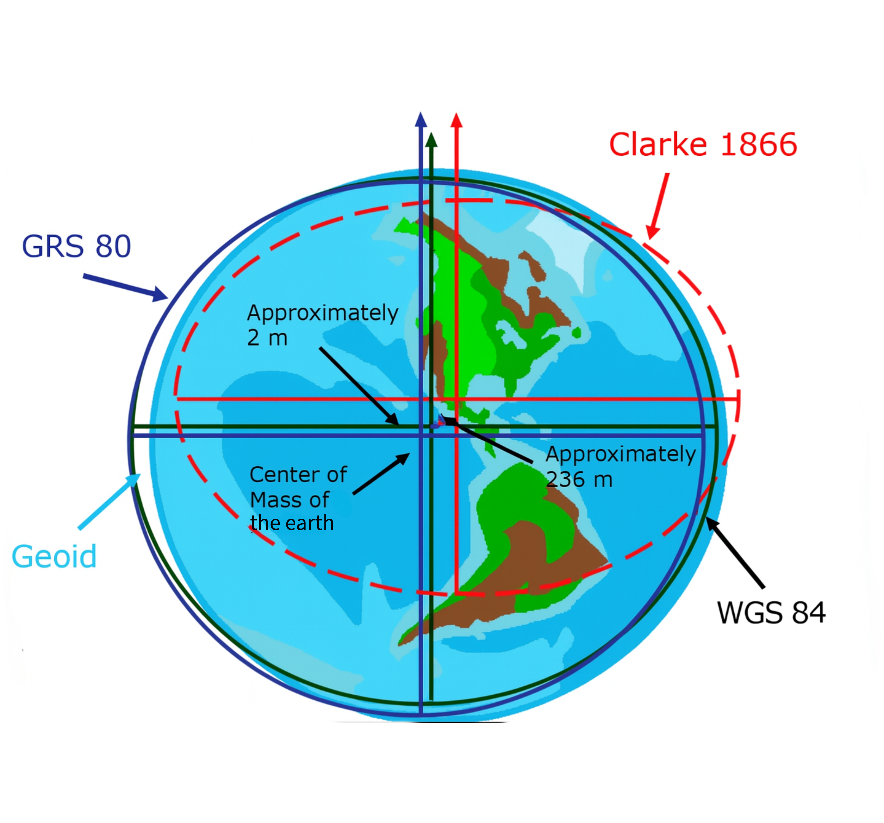
Representation of various reference ellipsoids
A reference system, which is a set of rules that define how a point's position is determined — in other words, how the coordinates are defined. In such systems, any location can be described using coordinates expressed in latitude and longitude, based on angular units (decimal degrees or degrees, minutes, and seconds).
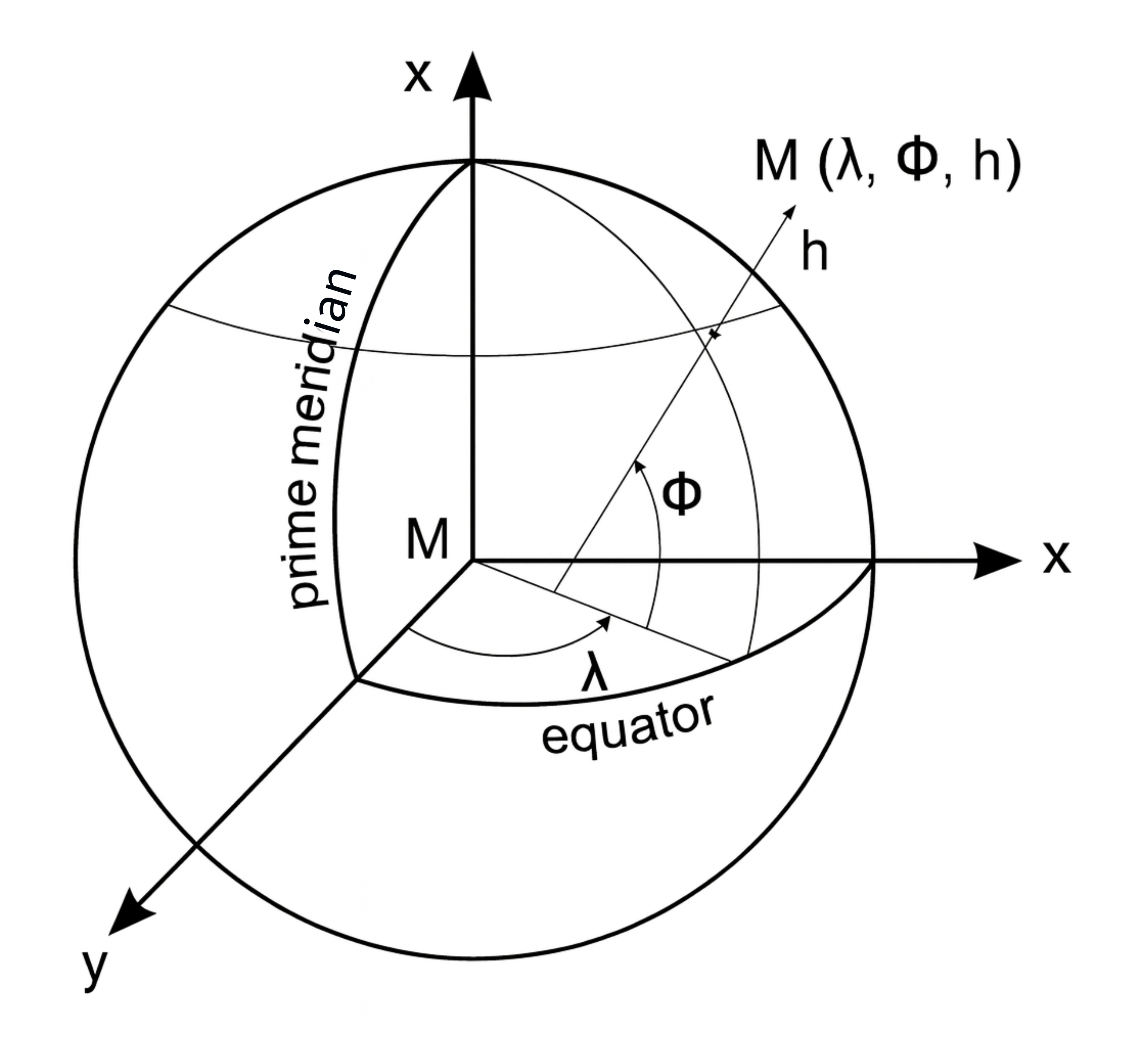
Representation of a point’s coordinates in decimal degrees
Projected Coordinate Systems (PCS)
A Projected Coordinate System has three components:
- A reference ellipsoid,
- A map projection (such as UTM, Lambert Conformal Conic, Mercator) that transforms geographic coordinates (latitude/longitude) into planar coordinates (x, y).
-638c7a1060dc31c6e6329fd01c14aa29.png)
Distortions associated with different map projections
- A reference system. In this case, a point can be represented using coordinates in linear units (e.g., meters). However, map projections always introduce distortions — it’s impossible to preserve both angles and areas perfectly at the same time.
In short, to obtain a projected map representation, the following steps are performed:
-df44522a4fff03091471db3aca5a5dcd.png)
What about datums?
Datums (or geodetic reference systems) are models of the Earth used to express geographic coordinates. A datum is defined by an origin (position relative to the Earth’s center), an orientation (axis alignment with the poles and a prime meridian), an ellipsoid (surface approximating the geoid), an angular unit, and a set of associated projections.
A complete example of a datum: RGF93
- Associated ellipsoid: IAG GRS 1980
- Orientation: Northeast
- Prime meridian: Greenwich
- Angular unit: sexagesimal degrees
- Common associated planar representations: Lambert 93, 9-zone conformal conic, UTM
- Accuracy: within a few centimeters
Coordinate Reference Systems (CRS) and EPSG Codes
A Coordinate Reference System (CRS) is composed of a projection and a datum. It defines the spatial reference in which elements can be located on Earth. These systems are collectively known as Coordinate Reference Systems (CRS) and are identified by unique EPSG codes.
For example:
The UTM Zone 31 North projection on the WGS84 ellipsoid corresponds to EPSG:32631.
Choosing the right system: criteria and use cases
So… how do you decide which coordinate system to use? It depends on your needs.
For non-cartographic applications (like navigation or GPS), it's better to use (latitude, longitude) coordinates, as they don’t involve distortions.
In 2D mapping, technically you can use any projected coordinate system — but a poorly chosen projection can introduce distortions in distance, angles, or surface area, which can hinder map readability and accuracy.
That’s why it’s important to use datums that are well adapted to your area of interest: an ellipsoid that best fits the Earth’s shape in that region, and a projection that fits your needs (Cylindrical, conic, Conformal (preserves angles), Equal-area (preserves surfaces), etc).
This way, your map representation will be as close to reality as possible.